ALERT
(Agricultural Land Environmental Risk and Opportunity Tool)
ALERT is a free mapping tool created by the Environment Agency on behalf of Catchment Sensitive Farming to help farmers and our local advisers analyse the landscape and reduce pollution from agriculture.
It is primarily used by our local advisers to help discussions and improve on-farm targeting of measures. The system is based on a collection of very detailed remotely sensed data such as slope and land form (LIDAR), satellite imagery, and many derived analyses to show both the combined risks and opportunities for pollution mitigation.
This is a desktop targeting tool. Land management decisions should only be made in conjunction with local knowledge, ground survey and professional advice. This map does not predict or infer where flooding is likely to occur.
Mobile vs Desktop
We have developed two configurations of the application, the desktop version and the mobile-friendly version. The desktop version does not display properly on a mobile phone, so we have developed a simplified version that is configured to display correctly on a small portrait screen like a mobile phone or a small tablet that can be used out in the field where 4/5g data connections allow. As this version has been configured for smaller mobile devices, it has slightly reduced functionality compared to the Desktop version.
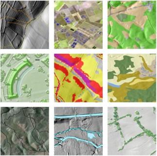
The Data Layers
ALERT has multiple ‘data layers’ you can toggle on and off when using. They have been carefully selected and optimised to provide a birds eye view of the landscape so that rapid assessments can be made about where risks might occur and where interventions are likely to have a meaningful impact.
For a full breakdown, visit the ALERT data layers page.
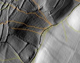
Overland Flow Pathways are a useful indicator of transport routes of water and pollutants across the landscape. When viewed in conjunction with satellite imagery, they can predict the crop marks caused by nutrient loading and soil erosion visible in the imagery.
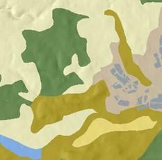
Soil Classification is important for determining how an Overland Flow Pathway might behave. Light Free Drainage soils are likely to be extremely prone to soil erosion and Phosphorous transfer. Heavy clay soils might be prone to waterlogging, compaction and run-off.
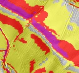
Slope Threshold can determine both the power with which water can erode soils and the distance it can carry pollutants across the land.
Accessibility
Users who do not have full colour vision may find it easier to use ALERT Alternative. The Alternative version has been produced to simplify the colour palettes where possible taking both protanopia and deuteranopia into consideration.
You can view the full Accessibility Statement here.